National Weather Summary for Wednesday, July 22, 2015
by WeatherOps, on Jul 22, 2015 4:55:56 AM
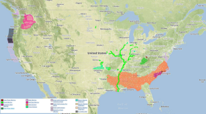
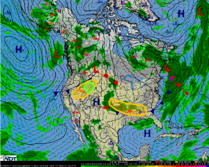
Strong to marginally severe thunderstorms are possible Wednesday across the Southeast and Central and Southern Plains, as well as the Intermountain West and Northern Rockies. Heavy rainfall is likely for the Northern Rockies.
A cold front will continue to progress southward across the Southeast with the tail end of the front remaining stationary across the Great Plains. High instability combined with forcing from the frontal boundary will allow for thunderstorms to develop and/or intensify across the region, mainly during the afternoon and early evening. A few strong to marginally severe thunderstorms will be possible with hail and gusty winds being the main threats.
Thunderstorms are forecast to develop across the Northern Rockies and Intermountain West this afternoon and evening ahead of a southeastward advancing cold front. Strong to marginally severe thunderstorms will be possible with hail and gusty winds the main threats.
In addition to the strong thunderstorms, a small portion of the Northern Rockies may receive rainfall rates in excess of one inch. Widespread flooding is not expected, but localized flooding is possible in locations receiving the heaviest rain.


