National Weather Summary for Friday, July 3, 2015
by WeatherOps, on Jul 3, 2015 4:46:46 AM
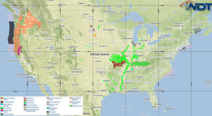
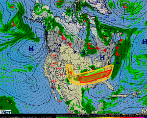
Severe thunderstorms are possible on Friday across portions of the Mid Atlantic, Southeast, and Southern Plains. Isolated strong to severe thunderstorms are possible across the High Plains. Heavy rainfall and flooding is possible across the Southeast.
A nearly stationary frontal boundary stretching from the Great Plains to the Mid Atlantic will provide a focus for strong to severe thunderstorm development today, especially during the aftermoon and evening. Outflow boundaries from ongoing thunderstorms may help enhance convection later today. Large hail and damaging winds will likely be the primary hazards, but a few isolated tornadoes cannot be ruled out.
Isolated thunderstorms are expected to develop this afternoon and evening across the High Plains from southeast Wyoming through eastern New Mexico and the Texas Panhandle. Daytime heating combined with a weak surface trough in the lee of the Rockies should allow for a few strong to severe thunderstorms, though overall coverage should be limited. Some of the stronger activity could produce large hail and damaging winds.
A nearly stationary front will allow for the potential for very heavy rainfall and an increased flooding threat for portions of the Lower Mississippi Valley eastward into the Tennessee and southern Ohio River Valleys into the overnight hours. In addition to the severe threat, 1-3 inches of rain will be possible. Those areas that received heavy rain on Thursday will be at an increased risk for flooding.


