


by Daphne Thompson, on Aug 28, 2017 2:55:34 PM
Rain continues to fall in the Houston Metro area as Harvey moves very slowly towards the Gulf of Mexico where he may re-strengthen and have another landfall near Galveston. Many neighborhoods are inundated by multiple feet of water and this disaster is not over yet.

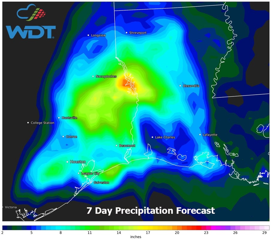
In the above image, you see the total precipitation that has fallen from August 24 - 28. The data are taken from our MetStorm Live product using higher quality rain gauges and combining them with dual-pol radar data to give a more accurate rainfall estimate. Many areas show more than 2 feet of rain has fallen - with more to come. The maximum on this map is 45 inches northwest of Mont Belvieu.

The Harris County Flood Warning System is very helpful in knowing where some of the heaviest rain has fallen. This is a 2-day total and many areas show over 20 inches of rain has fallen. The red arrow points Mont Belvieu and shows over 30 inches has fallen in 48 hours.

Clicking on that gauge allows viewing of data over the previous 7 days. The total now jumps to over 35 inches recorded in the same time period as the radar estimation. While there is not a gauge reading where the 45 inches of rain was shown, this is good verification to show an area that has already received approximately 9 months of the yearly rainfall in just a few days.


This rainfall is definitely a record setter. In the image above, the 24-hour Average Return Interval is shown for this event. Areas in red show are where a 1000-year 24-hour rain has occurred. It means that in any given year, there’s a 1-in-1000 (0.1 percent) chance of this much rain occurring. While not helpful for those with homes underwater, it is another way of showing how significant the situation is right now.

Rain is continuing to fall and with forecast of Harvey's path, rain may continue to fall for most of the week. Inland flooding also means water will continue to rise in areas near the coast as water flows back to the Gulf of Mexico.

Water levels in the bayous of Houston are peaking or expected to peak multiple feet above past records. Not only will they hit record levels, but some will remain at these levels for many day. Dams are being opened to release strain, which will contribute to more flooding downstream. This disaster isn't over when the rain stops.
