National Weather Summary for Thursday, February 13, 2014
by WeatherOps, on Feb 13, 2014 9:51:02 AM
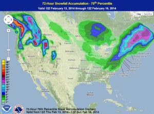
A strong area of low pressure moving northward along the East Coast is bringing significant snowfall to portions of the Northeast, mainly along and northwest of the I-95 corridor. A quick moving area of low pressure will bring moderate snowfall to portions of the Upper Midwest and Great Lakes. For the Pacific Northwest, moderate to heavy snow will continue for some of the higher elevations and rain in the lower elevations.
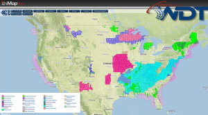
Current NWS Advisories/Watches/Warnings from iMapPro:

The center of the area of low pressure bringing the snow to the Northeast is located just north of Cape Hatteras, NC and will continue to move northeast or north northeast over the next few days. Snow will continue across the region through tomorrow before coming to an end on Saturday.
Another area of low pressure moving across the Upper Midwest and Great Lakes will bring moderate snow to portions of Minnesota and Wisconsin and then spread into Michigan throughout the day. Portions of the DC and Baltimore metro areas have picked up 12-18 inches of snow, and this area could pick up another 3-6 inches. In the Philadelphia area, 6-10 inches of snow have already been reported, with as much as 14 inches possible.8-14 inches will be possible for portions of the New York City metro area. For the Catskills, 12-18 inches of snow will be possible.
WDT preferred forecast for snow and ice accumulations through 7AM EST Friday


