National Weather Summary for Wednesday, February 5, 2014
by WeatherOps, on Feb 5, 2014 9:31:25 AM
Light to moderate snow will continue for the Midwest and the Great Lakes through the morning and early afternoon. Further to the east over the New England region, moderate to heavy snow will continue, but will begin to taper off by late afternoon and completely ending by midnight tonight. Across the Mid Atlantic, sleet and freezing rain will continue through early afternoon.
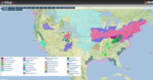
Current NWS Advisories/Watches/Warnings from iMapPro

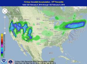
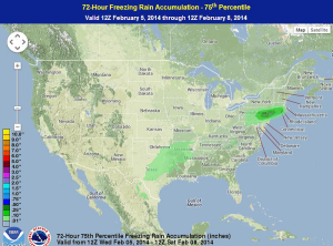
Before the snow comes to an end across the New England region, 6-12 inches of snow will be possible through the evening. In addition, for portions of the Mid Atlantic, ice accumulations could be as much as a quarter of an inch.
WDT preferred forecast for snow and ice accumulation


Elsewhere across the country, very cold temperatures have infiltrated much of the Central Plains. Temperatures for much of the High Plains and Upper Midwest are well below zero, and temperatures will not warm much in the short term. With winds gusting between 25 and 30 miles per hour, dangerously cold wind chills will be possible from portions of West Central Texas to Iowa.
Freezing rain left many in Arkansas without power on Tuesday. As of Wednesday morning, about 38,000 Entergy Arkansas customers were without power, in addition to another 10,400 Electric Cooperatives of Arkansas. In Kansas, wind chills will be as low as -25 with actual temperatures between 5 and 10 degrees. Freezing rain is also continuing for portions of Maryland with some parts of Maryland receiving up to a third of an inch of ice. 73,000 customers were without power near Baltimore and the number continues to rise.


