


by David Moran, on Jul 31, 2018 11:24:02 AM
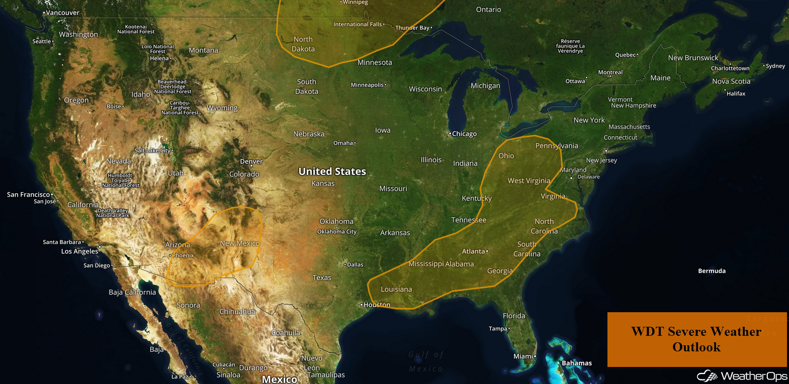
A cold front extending from the Ohio Valley into the Southeast will be the focus for thunderstorm development on Tuesday. Some of this activity, and additional activity on Wednesday, will have the potential to produce excessive rainfall from the Southeast into the Central Appalachians. Daytime heating will promote the development of thunderstorms across the Southwest during the afternoon and evening. Thunderstorms may develop across the Northern Plains ahead of a cold front.
- Thunderstorms from the Ohio Valley into the Southeast on Tuesday
- Excessive Rainfall through Wednesday for the Central Appalachians and Southeast
- Potential for Thunderstorms across the Southwest on Tuesday
- Risk for Thunderstorms Tuesday across the Northern Plains
- Thunderstorm Potential for the Upper Midwest on Wednesday
- Thunderstorms Wednesday across the Northeast
- Potential for Thunderstorms across the Southern High Plains on Wednesday
US Hazards
Thunderstorms from the Ohio Valley into the Southeast on Tuesday
An area of low pressure will begin moving eastward into the eastern US on Tuesday. A cold front will extend from the Ohio Valley into Louisiana. Scattered showers and thunderstorms will continue across much of the region during the morning. From midday into the evening, additional thunderstorms are expected to develop ahead of the front. Isolated severe wind and small hail will be potential hazards with the stronger storms.
Major Cities in Region: Baton Rouge, LA, New Orleans, LA, Jackson, MS, Birmingham, AL, Cincinnati, OH, Knoxville, TN, Atlanta, GA, Pittsburgh, PA, Raleigh, NC
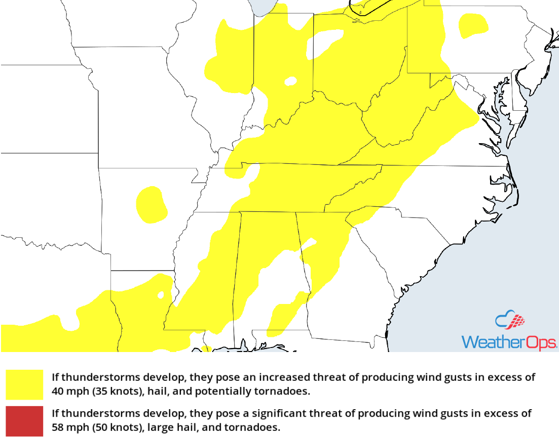
Thunderstorm Risk for Tuesday
Excessive Rainfall through Wednesday for the Central Appalachians and Southeast
An extended period of shower and thunderstorm activity is forecast over the next 48 hours from the Gulf Coast northeastward into the Central Appalachians due to an upper level low over the Lower and Middle Mississippi River Valley. While significant impacts are currently not forecast, there will be a risk for minor flooding and local runoff. Two day rainfall totals of 1-2 inches with locally higher amounts in excess of 3 inches are expected.
Major Cities in Region: Mobile, AL, Birmingham, AL, Atlanta, GA, Knoxville, TN, Blacksburg, VA
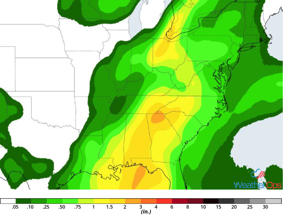
Rainfall Accumulation through Wednesday
Potential for Thunderstorms across the Southwest on Tuesday
Strong daytime heating across Arizona and New Mexico, as well as remnant outflow boundaries, should promote the development of isolated thunderstorms during the afternoon and evening. Damaging winds and large hail will be the primary hazards with the stronger storms, primarily before dark.
Major Cities in Region: Phoenix, AZ, Tucson, AZ, Truth or Consequences, NM, Las Cruces, NM, Alamogordo, NM
Thunderstorm Risk for Tuesday
Risk for Thunderstorms Tuesday across the Northern Plains
A cold front is forecast to move into the Northern Plains this afternoon. Isolated to scattered thunderstorms will likely develop across portions of North Dakota and Minnesota along the front. While widespread severe weather is not anticipated, a few storms will pose a low threat for strong winds and hail.
Major Cities in Region: Grand Forks, ND, Fargo, ND, International Falls, MN, Duluth, MN
Thunderstorm Risk for Tuesday
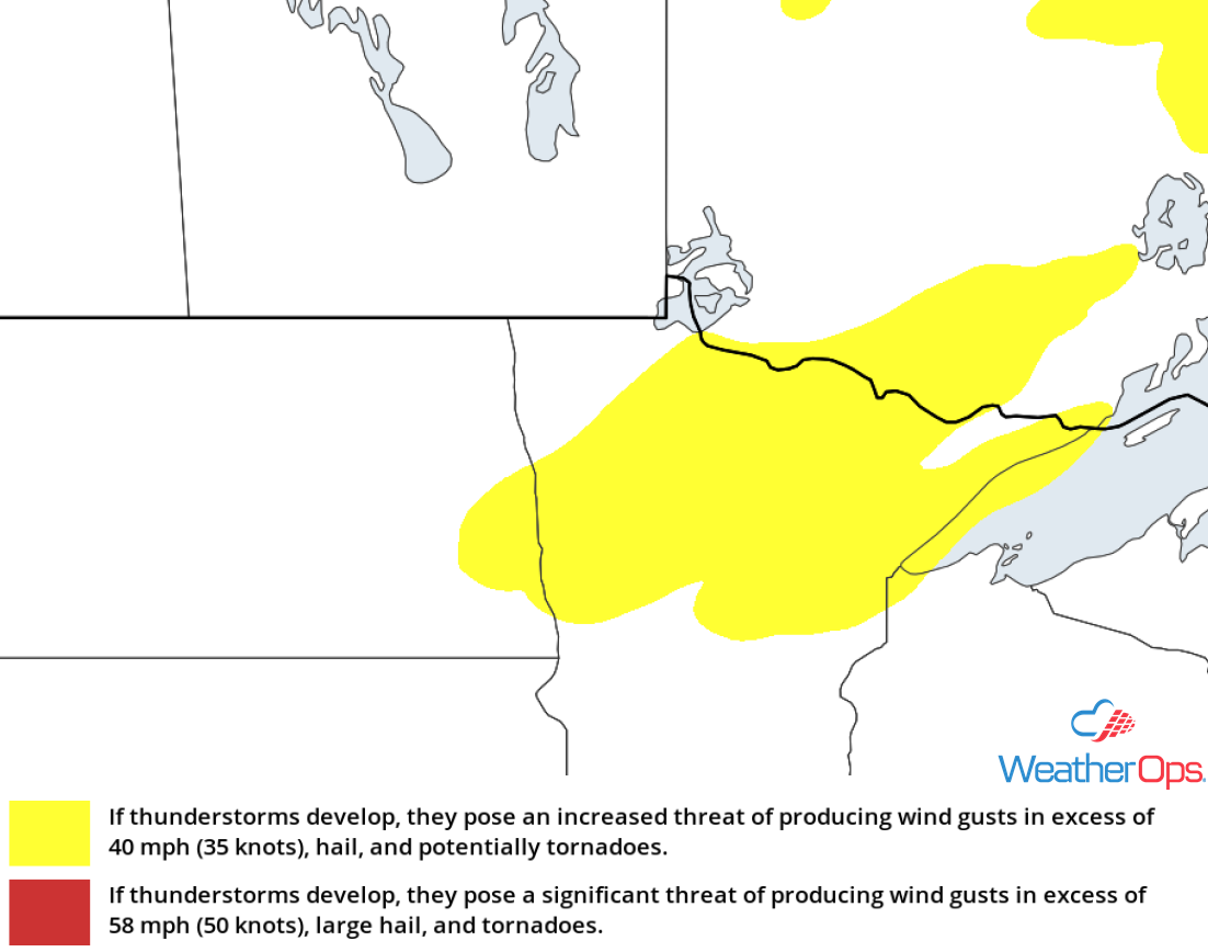
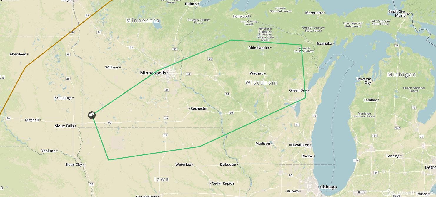
Thunderstorm Potential for the Upper Midwest on Wednesday
The cold front described above will continue to move to the south and east on Wednesday. A second round of showers and thunderstorms is forecast from the Minnesota/Iowa border eastward into Wisconsin. Strong winds and hail will be the primary hazards with the stronger storms. This activity may continue after dark.
Major Cities in Region: Minneapolis, MN, Rochester, MN, Wausau, WI, Green Bay, WI
SPC Convective Outlook for Wednesday
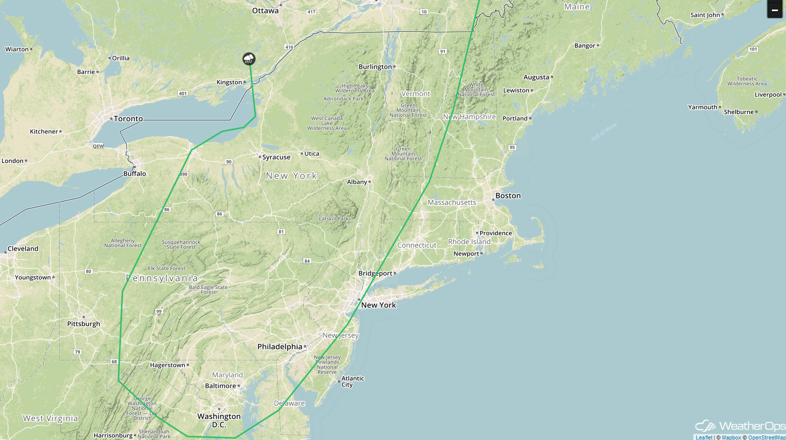
Thunderstorms Wednesday across the Northeast
An upper level trough will be in place over the Great Lakes on Wednesday. To the east of the trough, strong southwesterly winds aloft and building instability will support the development of thunderstorms from Maryland into Vermont. Strong winds and hail will be the primary hazards with the stronger storms.
Major Cities in Region: Washington, DC, Baltimore, MD, Philadelphia, PA, New York, NY, Albany, NY, Syracuse, NY
SPC Convective Outlook for Wednesday
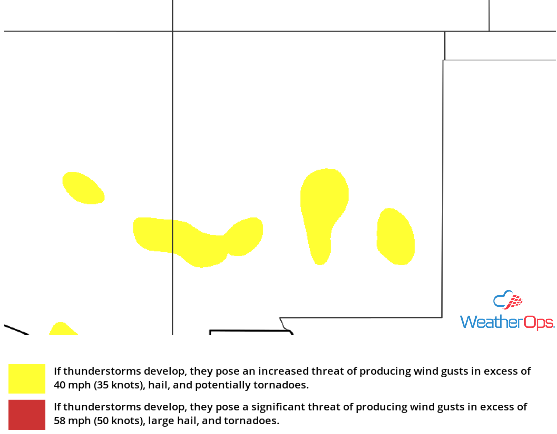
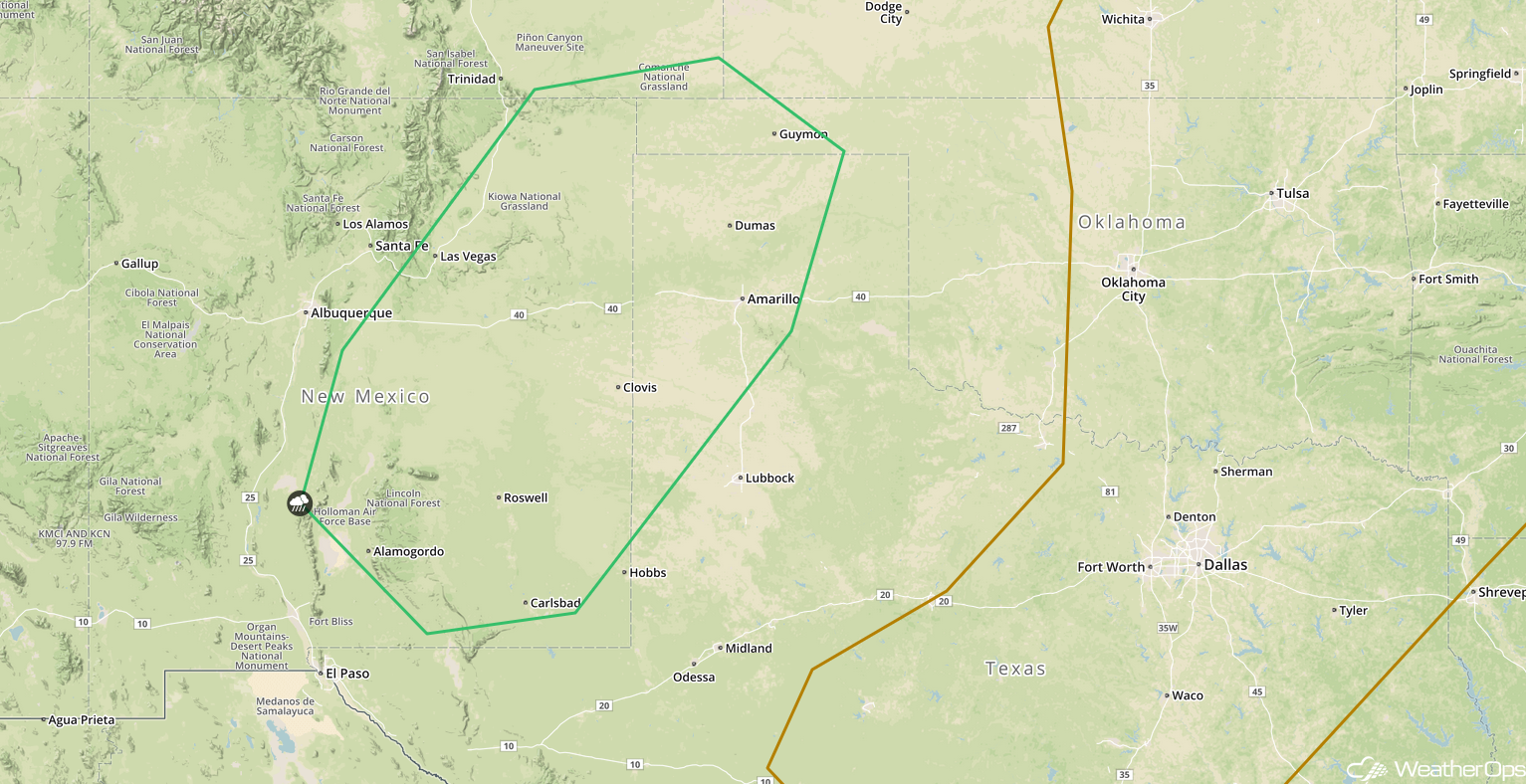
Potential for Thunderstorms across the Southern High Plains on Wednesday
There will be a potential for showers and thunderstorms across the Southern High Plains on Wednesday as daytime heating and upslope flow increase. Storms will develop during the afternoon and evening from New Mexico into the Oklahoma Panhandle. Strong winds and hail will be the primary hazards with any storms that develop.
Major Cities in Region: Alamogordo, NM, Roswell, NM, Carlsbad, NM, Amarillo, TX, Guymon, OK
SPC Convective Outlook for Wednesday
A Look Ahead
Showers and thunderstorms will continue from the Mid Atlantic into the Southeast on Friday ahead of a cold front. Late Friday, a cold front may allow for the development of thunderstorms across the Northern Plains. Heading into the weekend, thunderstorms may extend from the Upper Midwest into the Central Plains on Saturday as the cold front across the Northern Plains continues to move eastward. Additional thunderstorms may develop on Sunday. An area of low pressure may develop over the Northern Plains on Monday, bringing a potential for showers and thunderstorms to portions of the Northern Plains and Upper Midwest.
