


by David Moran, on Jul 30, 2018 11:14:28 AM
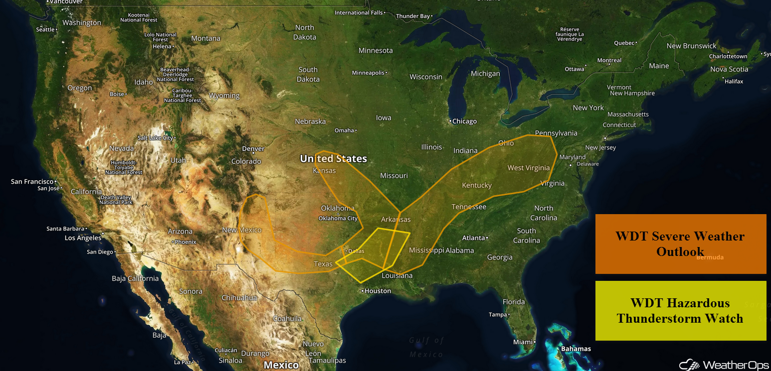
An area of low pressure over the Mid Mississippi Valley may allow for the development of thunderstorms from the Arklatex region into the Ohio Valley on Monday. Some of these storms may produce excessive rainfall across the Arklatex region. Thunderstorms are forecast to develop across the Southern High Plains as instability builds during the afternoon.
- Risk for Thunderstorms Monday from the Arklatex Region into the Ohio Valley
- Excessive Rainfall for the Arklatex Region Monday
- Thunderstorms Monday for the Southern High Plains
- Potential for Excessive Rainfall across the Southern States on Tuesday
- Excessive Rainfall Tuesday for the Mid Atlantic
- Risk for Thunderstorms across the Southern High Plains on Wednesday
- Thunderstorms Wednesday for Minnesota and Wisconsin
- Excessive Rainfall for the Southeast on Wednesday
US Hazards
Risk for Thunderstorms Monday from the Arklatex Region into the Ohio Valley
Warm moist air will be in place from Texas northeastward into the Ohio Valley on Monday. An upper level system will be slowly developing over the Plains, and an area of low pressure is expected to develop over the Mid-Mississippi Valley. It should move northeastward and its trailing cold front will progress southward through Oklahoma and Texas during the day. Strong to severe thunderstorms are expected to develop along and ahead of the front beginning in the afternoon hours. Damaging winds will be the primary hazards with these storms, but an isolated tornado or two cannot be ruled out.
Major Cities in Region: Texarkana, AR, Shreveport, LA, Memphis, TN, Evansville, IN, Cincinnati, OH
Thunderstorm Risk for Monday
Excessive Rainfall for the Arklatex Region Monday
In addition to the severe weather threat described above, there will be a risk for excessive rainfall. Thunderstorms will move across the region during the morning hours. Another round of thunderstorms are expected during the afternoon, bringing additional rainfall to the region. Rainfall totals will range 1-2 inches with locally higher amounts in excess of 3 inches.
Major Cities in Region: Longview, TX, Texarkana, AR, Shreveport, LA
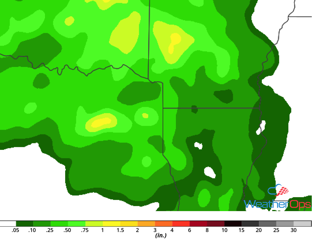
Rainfall Accumulation for Monday
Thunderstorms Monday for the Southern High Plains
Upslope flow, combined with daytime heating, will allow for the development of isolated strong to severe thunderstorms. These thunderstorms should develop during the mid afternoon with damaging winds the primary hazard, but some large hail cannot be ruled out.
Major Cities in Region: Lubbock, TX, Amarillo, TX
Thunderstorm Risk for Monday
Potential for Excessive Rainfall across the Southern States on Tuesday
A slow moving cold front will extend across portions of the Deep South on Tuesday, with showers and thunderstorms expected along and ahead of the front. Very moist air will be in place, allowing for the potential for heavy rainfall. Rainfall totals of 1-2 inches are expected with locally heavier amounts in excess of 3 inches.
Major Cities in Region: Jonesboro, AR, Jackson, TN, Huntsville, AL
Rainfall Accumulation for Tuesday
Excessive Rainfall Tuesday for the Mid Atlantic
Rainfall is expected across portions of the Mid Atlantic region on Tuesday ahead of a slow moving upper level trough. Accumulations of 0.50-1.00 inch with locally higher amounts in excess of 2 inches are forecast. Some areas have received rainfall in the past few days and additional rainfall may cause some flash flooding.
Major Cities in Region: Richmond, VA, Norfolk, VA, Salisbury, DE
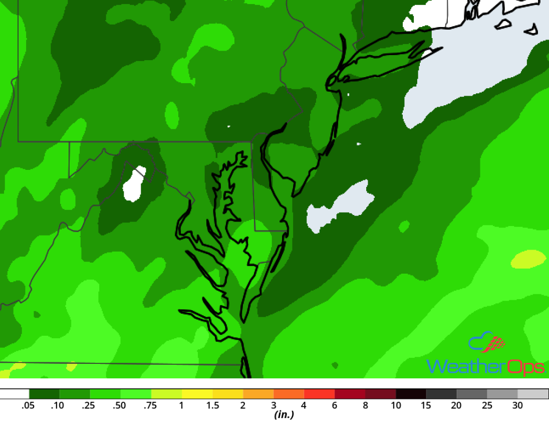
Rainfall Accumulation for Tuesday
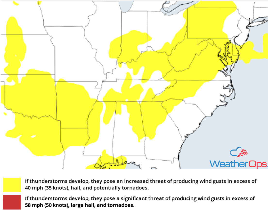
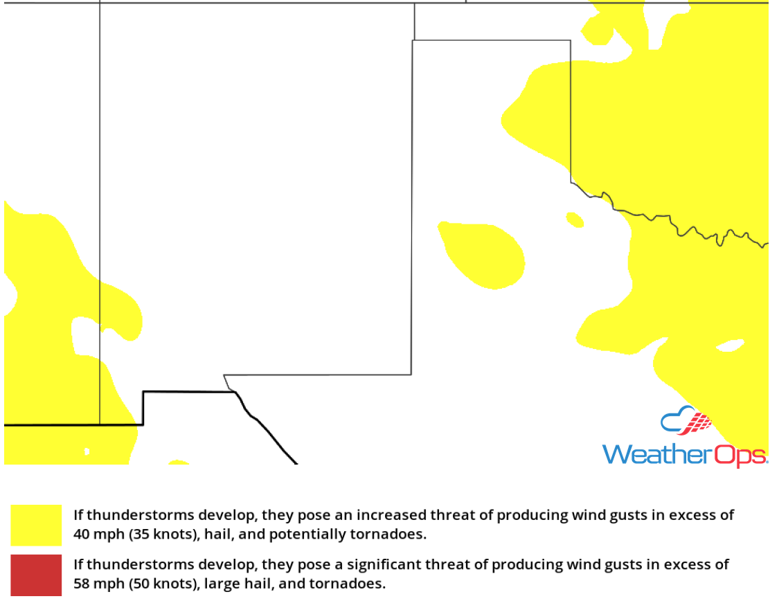
Risk for Thunderstorms across the Southern High Plains on Wednesday
Showers and thunderstorms are expected to develop in the higher elevations of eastern New Mexico on Wednesday. Southeasterly flow will keep moist air in the region. With instability building, isolated strong to severe thunderstorms will likely develop during the afternoon and move to the east and southeast. Damaging winds and large hail will be the primary hazards with these storms.
Major Cities in Region: Alamogordo, NM, Carlsbad, NM, Roswell, NM, Amarillo, TX, Guymon, OK
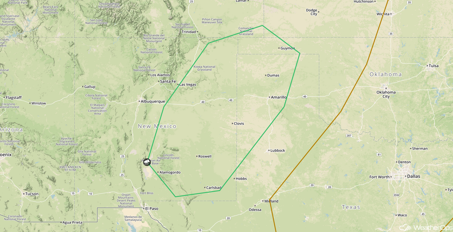
SPC Convective Outlook for Wednesday
Thunderstorms Wednesday for Minnesota and Wisconsin
A cold front is expected to move into the region on Wednesday, which will serve as a focus for the development of thunderstorms. Damaging winds will be the primary hazard with the stronger storms.
Major Cities in Region: Minneapolis, MN, Rochester, MN, Wausau, WI
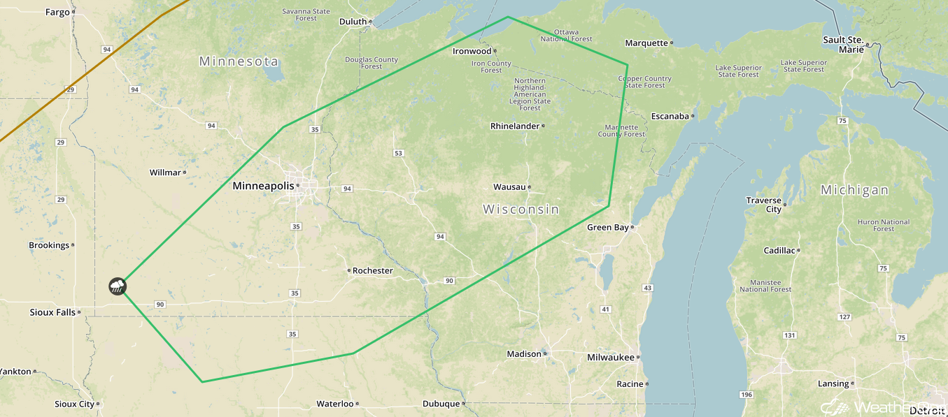
SPC Convective Outlook for Wednesday
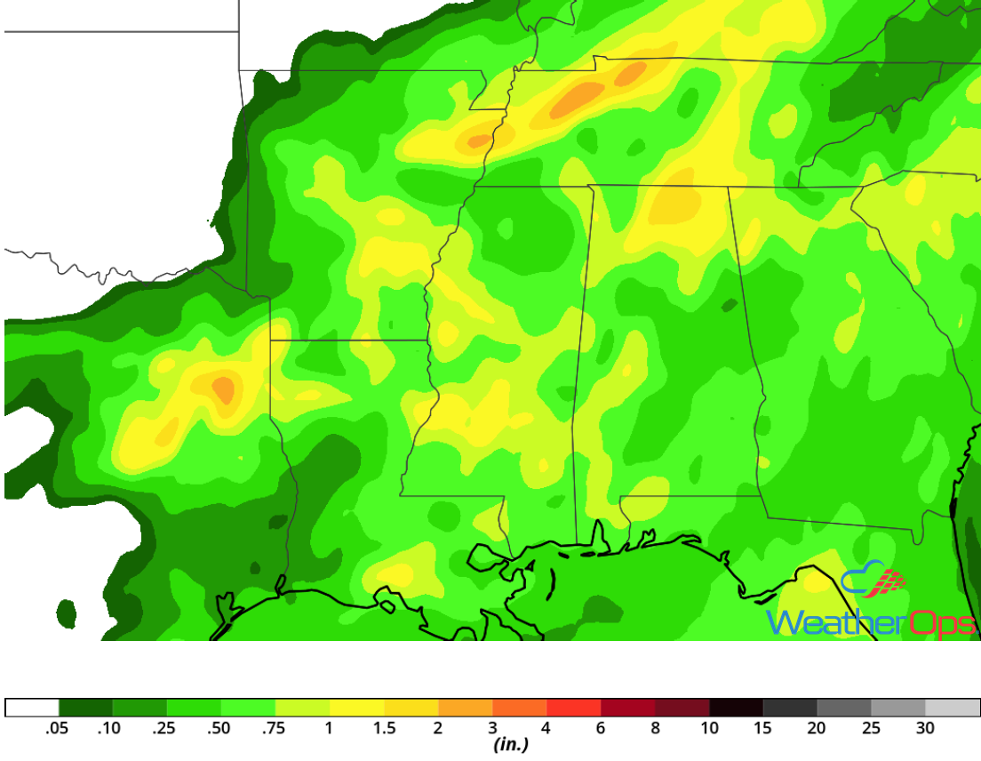
Excessive Rainfall for the Southeast on Wednesday
An upper level trough will continue to move across the eastern US on Wednesday, bringing a large area of southwesterly flow over the Southeast. Weak disturbances will move over a slow moving cold front, allowing for the development of thunderstorms along and ahead of the front. With plentiful moisture in place, rainfall amounts of 1-2 inches and locally higher amounts in excess of 3 inches are expected.
Major Cities in Region: Biloxi, MS, Mobile, AL, Atlanta, GA
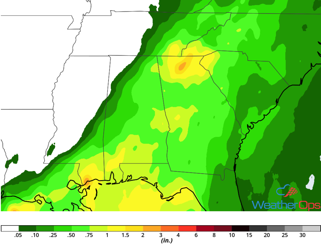
Rainfall Accumulation for Wednesday
A Look Ahead
Showers and thunderstorms will continue across the Southeast and Mid Atlantic on Thursday ahead of a cold front. This activity may expand into the Northeast on Friday. By Saturday, a cold front will be the focus for the development of showers and thunderstorms across the Upper Midwest. Thunderstorms could spread into the Great Lakes on Sunday.
