


by David Moran, on Aug 10, 2018 11:16:06 AM
A stationary front will be the focus for thunderstorm development across Texas, posing a risk for excessive rainfall through Sunday. Thunderstorms are forecast across Arizona as instability builds through the afternoon. Some storms will have the potential to produce excessive rainfall. A weak cold front will provide forcing for thunderstorm development across the Midwest. Heavy to excessive rainfall is forecast for portions of the Northeast as a cold front moves through the region.
- Risk for Excessive Rainfall through Sunday across Texas
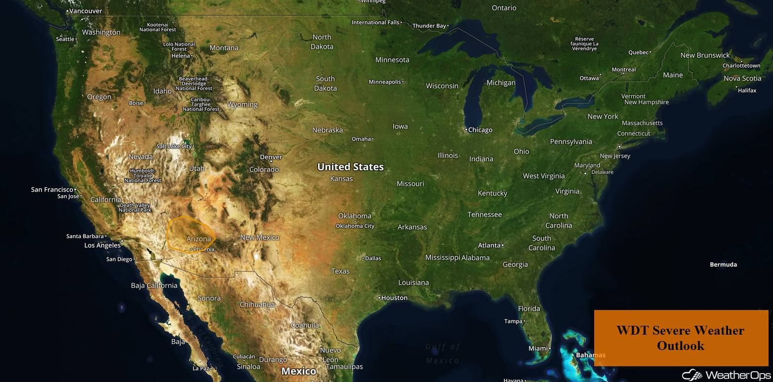
- Potential for Thunderstorms across Arizona on Friday
- Excessive Rainfall through Saturday across Arizona
- Thunderstorms across the Midwest on Friday
- Excessive Rainfall Friday for the Northeast
- Tropical Update
 US Hazards
Risk for Excessive Rainfall through Sunday across Texas
A stalled front will extend across South Texas throughout the day today. With onshore flow from the Gulf of Mexico, ample moisture will be present, leading to the development of showers and thunderstorms. Some of these storms could produce heavy to excessive rainfall. Rainfall accumulations today will range 1.00-1.50 inches with locally higher amounts in excess of 2 inches. Into tomorrow and Sunday, an area of low pressure is expected to develop over South Texas and slowly lift toward the north-northeast. With this system and the Gulf Moisture in place, an additional 2.00-2.50 inches are forecast on Saturday and Sunday. Three day rainfall accumulations of 3-5 inches with locally higher amounts in excess of 7 inches are expected. This will result in a potential for flooding and flash flooding.
Major Cities in Region: San Angelo, TX, Abilene, TX, Austin, TX, Fort Worth, TX, Dallas, TX, Tyler, TX

Rainfall Accumulation for Friday
Potential for Thunderstorms across Arizona on Friday
An upper level high is forecast to remain to the north of the area with northeasterly winds aloft continuing. With rich moisture at the surface and daytime heating, strong to severe thunderstorms are expected to develop. Strong wind gusts and large hail will be the primary hazards with these storms.
Major Cities in Region: Flagstaff, AZ, Phoenix, AZ, Tucson, AZ
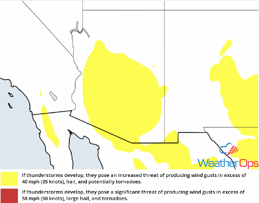
Thunderstorm Risk for Friday
Excessive Rainfall through Saturday across Arizona
In addition to the thunderstorm risk described above, there will be a potential for excessive rainfall. With additional heavy rainfall expected on Saturday, two day rainfall accumulations will range 2-3 inches. This will allow for the potential for flooding and flash flooding.
Major Cities in Region: Flagstaff, AZ, Phoenix, AZ, Tucson, AZ
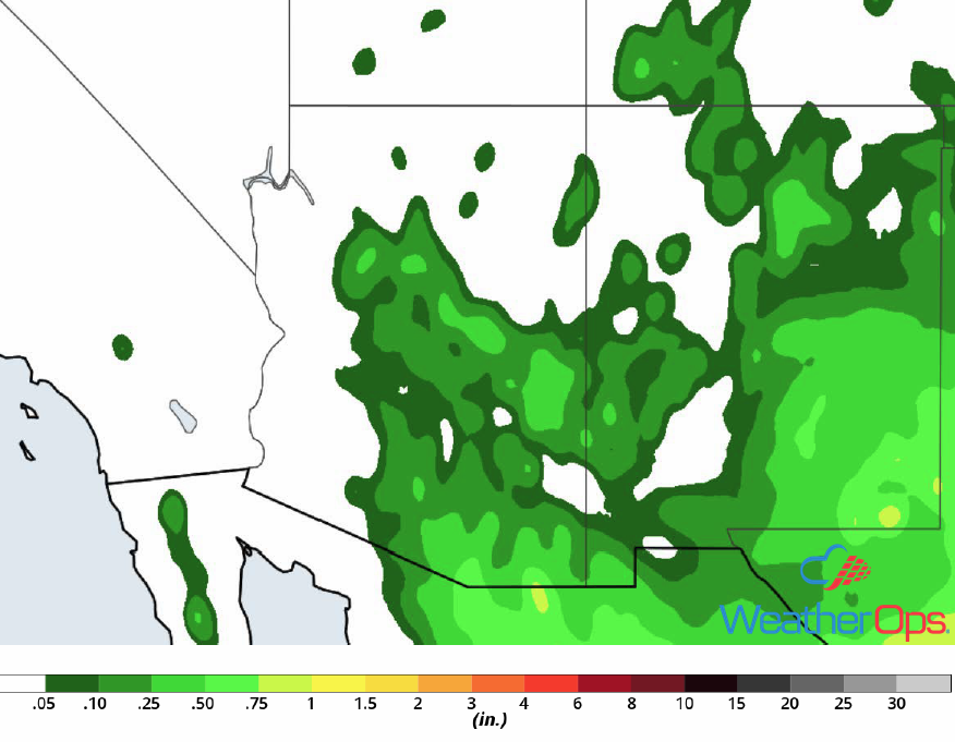
Rainfall Accumulation through Saturday
Thunderstorms across the Midwest on Friday
A weak cold front is forecast to progress through the Midwest across Indiana and Ohio throughout the day. By the afternoon, daytime heating and moisture ahead of the front will allow instability to build. This will lead to the development of strong to severe thunderstorms. Strong winds will be the primary hazard, but there will also be a risk for frequent lightning and heavy rain.
Major Cities in Region: Indianapolis, IN, Columbus, OH
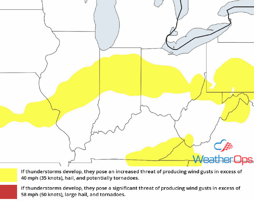
Thunderstorm Risk for Friday
Excessive Rainfall Friday for the Northeast
A cold front is expected to move across the region throughout the day. Ahead of the front, heavy precipitation is expected. Rainfall accumulations will range 1.00-1.50 inches with locally higher amounts in excess of 2.00 inches. Due to the rainfall over the last week across the region, there will be a potential for flooding and flash flooding.
Major Cities in Region: Pittsburgh, PA, Scranton, PA
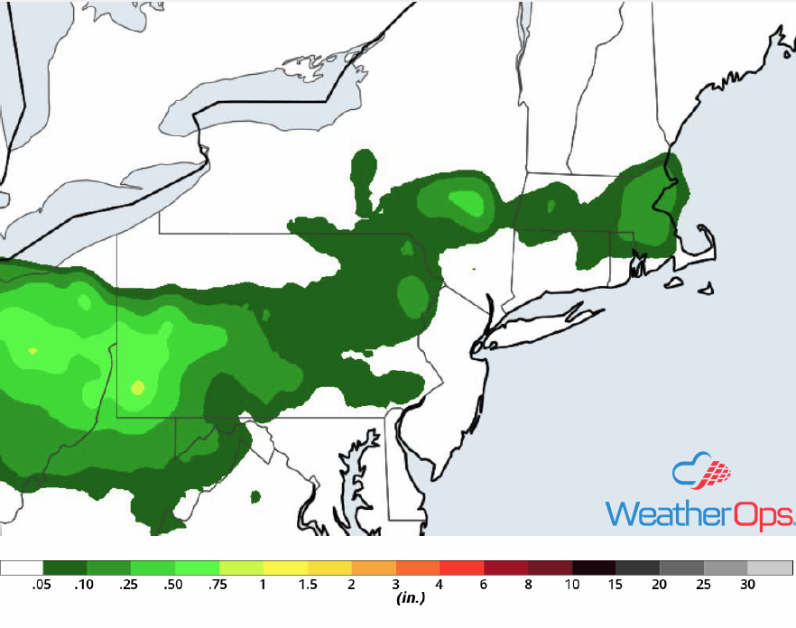
Rainfall Accumulation for Friday
Tropical Update
An area of disturbed weather is located between Africa and the Lesser Antilles. Environmental conditions are expected to become favorable for some gradual development while the system slowly moves westward over the next few days. By the middle of next week, stronger upper level winds could limit the potential for further development.
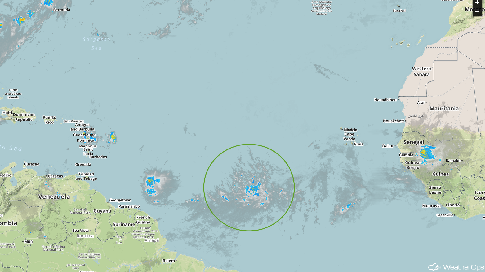
Enhanced Infrared Satellite
A Look Ahead
Excessive rainfall will continue across West Texas into the Southern Plains on Monday along a stalled front. Rainfall accumulations will range 1-3 inches with locally higher amounts in excess of 4 inches. By Tuesday, some of this activity may move into the Central Plains. Additionally, showers and thunderstorms may develop across the Northern Plains and Upper Midwest along a cold front. Heavy rain will extend from the Southern Plains into the Great Lakes on Wednesday. On Thursday, heavy rain will extend from the Great Lakes into the Ohio River Valley.
