


by Steve Miller, on Jan 11, 2018 11:39:57 AM
Norman, OK – January 10, 2018 — Weather Decision Technologies®, Inc. (WDT), the leading decision support and weather analytics company announces the launch of 48 new weather data services that compliment an already robust GIS offering. WDT’s success with real-time high availability commercial weather data services built on ESRI’s ArcGIS Enterprise platform has prompted WDT to expand this offering.
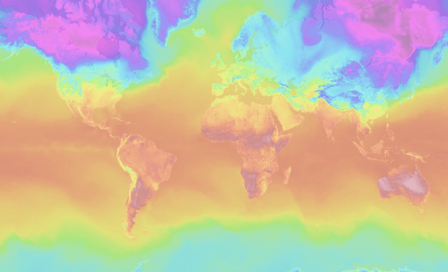
Included in the 48 new data services are global current conditions analysis, global forecast data out to 10 days, and high-resolution forecast data over North America. These services are built on WDT’s global weather data platform which provides industry leading forecast and historical data.
“The ArcGIS Server makes it very easy for customers using ESRI maps and applications to easily plug and play these data services into what they’ve already created” says Matt Gaffner, WDT’s GIS Weather Solutions Guru. “The handshake is pretty seamless behind the scenes between an ESRI application and an ESRI data service. For organizations not using ESRI for mapping, WDT’s new data services can also be consumed in alternative interactive mapping applications.”
WDT’s high resolution forecast data can extend existing maps and applications built by ESRI users across many industries, enabling them to build new applications for spatial analysis. For example, traders in weather sensitive commodities can glean more insights, utilities can forecast load, and agricultural operators can better predict how weather will impact their operations.
CONUS Analysis (ImageServer)
- Dewpoint Temperature
- Temperature
- 1 and 24 hr Precipitation
- Relative Humidity
- 1 hr Solar Radiation
- Wind Direction and Speed
Global Analysis (Image Server)
- Dewpoint Temperature
- Temperature
- 24 hr High & Low Temperature
- Evapotranpsiration Short & Tall
- Temperature
- 1 and 24 hr Precipitation
- Relative Humidity
- 1 and 24 hr Solar Radiation
- Wind Direction and Speed
Global Forecast (Image Server)
- 1 hr Cloud Cover
- 1 hr Dewpoint Temperature
- 1 and 24 hr Precipiation
- 3 hr Precipitation Probability
- 1 hr Relative Humidity
- 1 hr Snow
- 1 hr Temperature
- 6 and 24 hr High and Low Temperature
- 3 hr Thunderstorm Probability
- 1 hr Wind Direction, Speed & Gust
- Marine - 1 hr Swell Direction, Period & Height
- Marine - 1 hr Wave Height
- Marine - 1 hr Wind/Wave Direction & Height
Models (Feature & Map Server)
- HPA
- LAPS
- CONUS Lightning Prediction
- CONUS QPE (Quantitative Precipitation Estimate)
Observations (Feature & Map Server)
- Current Hail
- Hail (Years, 2013-2017)
- Lightning CONUS, Canada & Alaska
- Lightning - Global
- Surface Obs - CONUS
- Surface Obs - Global
- Watch/Warning - CONUS
- Fronts & Pressure Centers
- Local Storm Reports (LSR) 2014-2107
- Snow & Ice Outlooks
- SPC (Storm Prediction Center) Outlook
Radar (Map Server)
- CONUS - Current & 3 hr Loop
- Australia - Current & 60 min Loop
- Europe - Current & 60 min Loop
- Japan - Current & 60 min Loop
- North America - Single Scan & Past Loop
- Storm Attributes (+Feature Server)
- TornadoTrax (+Feature Server)
Satellite & Tropical (Map Server)
- Global Infrared - Current & 6 hr Loop
- Current Tropical (+Feature Server)
- Tropical Forecast Models (+Feature Server)
- Tropical Archive 2013 - 2017 (+Feature Server)
About WDT, Inc.
Headquartered in Norman, OK, WDT provides organizations with actionable weather analytics and decision support. The company, an ESRI Silver Partner, helps clients leverage weather information for profit and safety globally. Hazardous weather detection, prediction, and decision analytics are available via APIs and GIS layers, as well as WDT’s leading risk mitigation SaaS platform, WeatherOps®. WDT takes business continuity activities to the next level by assigning expert meteorologists to monitor global assets and provide live, one-on-one consulting before and during severe weather situations.
